TTC introduces interactive Live Map pilot
The TTC is piloting the launch of a new, interactive Live Map to help customers navigate the system with greater confidence and real‑time awareness.
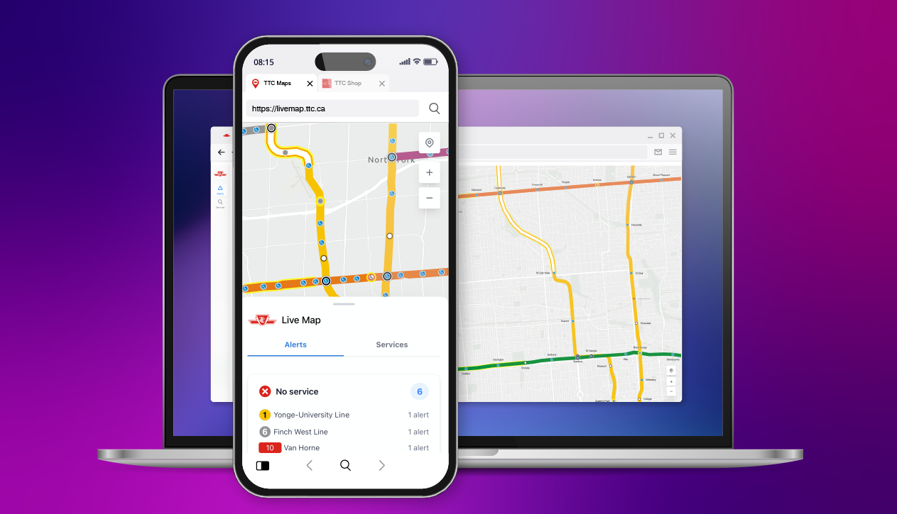
The first version of the Live Map will provide a clear, interactive view of subway and light rail transit (LRT) service across the network. Bus and streetcar routes will be added in a future update, targeted for release later this year.
What is the Live Map?
The Live Map gives you a high‑level, real‑time view of TTC rapid transit service, including:
- Subway and LRT lines displayed on an interactive map
- Real‑time service status, including any outages or disruptions
- Subway station information, including real-time departure times of all connecting services
- Accessible stations, clearly marked with the wheelchair symbol
- Light or dark mode options for comfortable viewing
Why the TTC is piloting the Live Map?
The TTC is releasing the Live Map in phases to gather customer feedback and refine the experience before further expansion. Customer input will be critical in helping to shape the final version of this interactive tool.
How to access the Live Map?
The Live Map can be found within the recently upgraded Live Service Alerts section on TTC.ca or by visiting the dedicated Live Map webpage. When users click on “View Map” in the section, the map will expand to give you a full view of the network.
Features and Tools
The Live Map includes a navigational panel where you can explore:
- Service Details: View real‑time train and bus departure information, occupancy levels, and station features.
- Map Tools: Learn how to navigate the map, zoom in and out, and switch between light and dark mode.
- Location Services: Enable your device’s location to see nearby stations and have the map follow your position.
- Feedback: Share your thoughts directly with our development team through a built‑in web form.

Accessibility
The Live Map is fully compliant with the Accessibility for Ontarians with Disabilities Act. Screen readers will remain within the information panel for a smooth, accessible experience.
We want to hear from you!
Customer feedback is essential for the Live Map pilot. Look for the “Send Feedback” option within the map to share your comments directly with our team.